| Preface In the year 1999, when still everything was very
much undefined about the reconstruction design, General Engineering was asked to provide
preliminary technical documentation about the studies that could be worked out for the Old
Bridge of Mostar.
On that occasion some tentatives were
performed although the source data available were still very scarce and not in final
formats.
The results and comments are contained in
the following technical report: of course most of the contents are not anymore
updated any many things are innacurate, but this report let us understand, on one side,
how difficult it was to start a work of the kind, and on the other, how many design
strategies were correctly started from the very beginning.
By the right side there are some pages of
the report in its original layout.
Preliminary studies for the Old Bridge have been
developed by General Engineering during the years 1996-1999 on its own, with no help, few
data and no resources.
Authors of the text: Manfredo Romeo -
Bernardo Rossi - Giovanni Checcucci.
In this first part of the document there are the
following paragraphs:
towards the 3D model of the stone arch
survey of the existing portions
purpose built software for managing data
|
|
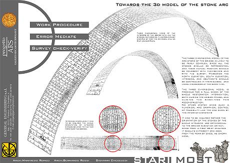
TOWARDS THE 3D MODEL OF THE STONE
ARCH
The three dimensional model of the arc stone of the
bridge is likely to be fairly complex, since all the stones should be represented, and
their mutual position should be coherent with themselves and with the survey. Moreover the
north elevation, south elevation, intrados, and abutments should be controlled in their
global and local measures at the same time.
The three dimensional model is precious for a full check of the whole restoration
intervention, both during the design phase, and during the workings for reconstruction.
No other system gives such a numerical and graphical control of feasibility like the one
given by the informatic systems
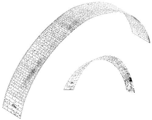
Three dimensional views of the intrados of
the bridge with all the stones textured on it, as preliminary example of how the 3d model
will be complex.
It has to be inquired wether the orientation of the stones of the whole intrados are
orthogonal to the bridge elevation or not, since from a first brief analysis it results
different one area from the near by ones, as shown here.
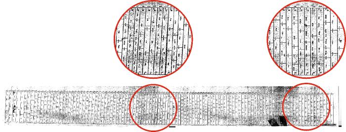
Intrados anomalies: it has to be inquired the
whole orientation of intrados stones related to the two fronts of the bridge.
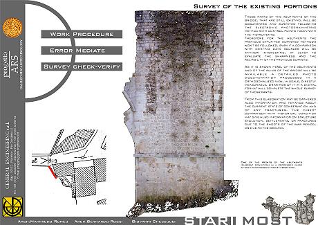
SURVEY OF THE EXISITING
PORTIONS
Those parts of the abutments of the bridge, that are
still existing, will be documented and surveyed following the electronic photogrammetric
method with control points taken with the instruments.
Therefore for the abutments the previous explained surveyed methods won't be followed,
even if a comparison with existing data sources will be anyhow interesting, at least to
evaluate the sharpness and the reliability of the previous surveys.
As it is shown here, of the abutments and of the ruins of the bridge will be available a
detailed photo documentation processed in a orthogonalized view, in scale, directly
measurable. Drawings of it in a digital format will complete the whole survey of those
parts.
From this elaboration may be gathered also information and tematics about the current
state of conservation and of any fractures. The direct comparison with historical
condition may give also information on structure evolution, settlements, or fractures due
to the shoots of the war period, or due to the ground.
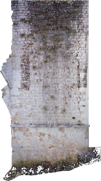
One of the fronts of the abutments (current
condition) in a processed image after a photogrammetric elaboration.
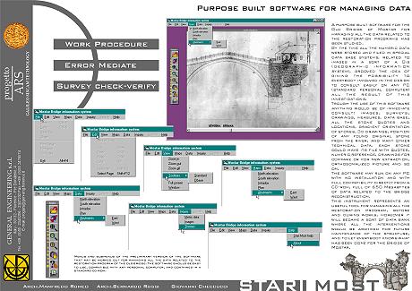
PURPOSE BUILT SOFTWARE
FOR MANAGING DATA
A purpose built software for the Old Bridge of
Mostar for managing all the data related to the restoration programs has been studied.
By the time all the numeric data were stored and filed in special data base systems,
related to images in a sort of a Gis (geographic information system), grooved the idea of
giving the possibility to everybody involved in the design to view easily on any PC
(standard personal computer) all the result of this investigations.
Trough the use of this software anything would be of easy check: images, surveys,
drawings, measures, data base, all the stone dimensions and locations, gradient
orientation of stones, 3d drawings, position of any found original stone from the river,
and many other technical data. each stone could have its file with dimensions, numeric
reference, drawings for compare or for new extraction, orthogonalized picture and so on.
The software may run on any PC with no installation and with full compatibility directly
from a CD-rom, full of 650 Megabytes of data related to the bridge reconstruction.
This instrument represents an useful tool for managing all the restoration plan, before
and during works, moreover it will became a sort of data base where all the interventions
would be archived for future maintenance of the structure, and to let everybody knows what
has been done for the Bridge of Mostar.
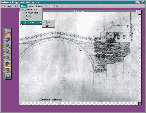
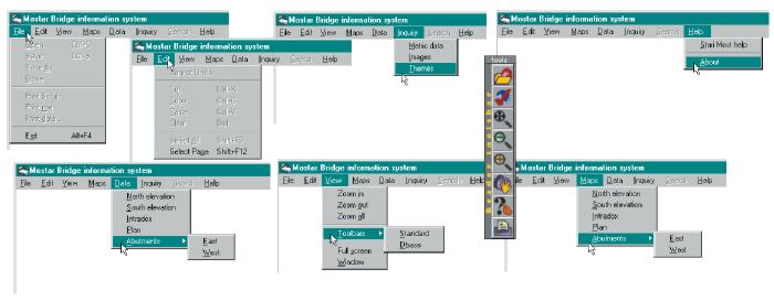
Menus and submenus of the preliminary version
of the software that may be worked out for managing all the data related to the
restoration program of the old bridge. The software should be easy to use, compatible with
any personal computer, and contained in an ordinary cd-rom.
|